What if your morning view was a wide desert sky, your street was quiet enough to hear the wind, and your weekends were filled with simple, close-to-home adventures? If you’re craving space, value, and a slower pace, California City may be on your radar. In this guide, you’ll get a clear look at everyday life, commuting, recreation, and the housing landscape so you can decide if it fits your goals. Let’s dive in.
Why California City feels different
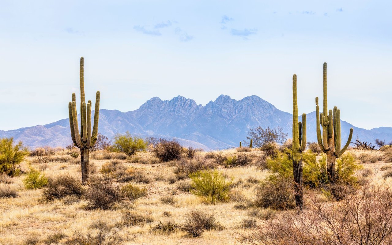
California City sits in the northern Antelope Valley with a vast footprint of about 203.6 to 203.7 square miles and a 2020 population of roughly 14,973. That size means low density, long views, and a lot of open land. The climate is high desert: hot, dry summers, cooler evenings, and big temperature swings. Many neighborhoods cluster on the city’s west side, and you’ll notice a planned-community layout with finished streets and some undeveloped lots, which keeps things quiet.
Daily life and essentials
Basics you can do in town
You can handle day-to-day errands without leaving the city. Expect small-town anchors like hardware, banks, convenience stores, local eateries, and basic medical services. For civic info and local business listings, start with the city’s departments and directory page on the City of California City website. For big-box shopping or more specialized services, plan on a drive to larger nearby communities.
Schools and district info
Public schools are part of the Mojave Unified School District, including California City Jr./Sr. High and two elementary schools. If schools are part of your move, verify attendance boundaries and program details directly with the district. You can find district contacts and campus information on the Mojave Unified School District site. Keep your research neutral and focus on fit, programs offered, and commute logistics.
Healthcare access
In-town clinics and urgent care cover basic needs, but for hospital care, you’ll likely go to Tehachapi or Bakersfield. That is a common tradeoff in rural desert living. Confirm exact drive times from your address and any specialist access you need before you move. Local clinic and service updates often appear on the city’s community information pages.
Public safety and city services
California City operates its own police and fire departments. That local presence is important for community programs and response. For general contacts and department links, use the city’s departments directory.
Getting around
Driving and major routes
Life here is car-first. You’ll use Highway 14 to the west and Highway 58 to the south for regional trips. Expect rural driving distances for hospitals, major shopping, and many job centers. Bakersfield is about 68 miles and roughly 1 hour 10 to 15 minutes by car, depending on route and traffic.
Public transit options
Kern Transit provides intercity service and a local Dial-A-Ride within the city. Route 250 connects California City to Lancaster, where you can link up with Metrolink for trips into the Los Angeles area. Schedules and maps are available on Kern Transit. Transit helps for occasional commutes, but it is not a complete substitute for a car.
Airports and air travel
California City Municipal Airport (L71) supports general aviation and hobby flying; see specs and field details on AirNav for L71. The Mojave Air and Space Port is a short drive away and adds to the area’s aerospace character, with occasional testing and events; get a sense of proximity with this distance reference. For commercial flights, the nearest scheduled service is in Bakersfield at Meadows Field; check current airlines and routes on the Meadows Field information page.
Weekend recreation
Tee times close to home
Golf is an easy go-to for many residents. The Tierra del Sol complex offers an 18-hole course and a par-3 option right in town, making it simple to fit a quick round into your week. Learn more about the layout and amenities on the Tierra del Sol course page.
Parks, trails, and day trips
Red Rock Canyon State Park is a quick drive and a favorite for hiking, photography, and desert geology. Spring brings wildflower viewing throughout the Antelope Valley, and nearby public lands offer off-highway vehicle zones and wide-open exploration. Start your park planning with this Red Rock Canyon overview. If you value quiet at home, remember that OHV and motocross culture is part of the local lifestyle, so choose your neighborhood accordingly.
Night skies and desert calm
Clear, starry nights are a frequent perk. Many residents enjoy after-dinner walks or backyard stargazing once the sun drops and the air cools. If you like a slower pace and simple outdoor routines, this setting fits well.
Housing snapshot and who it fits
Home types and lot patterns
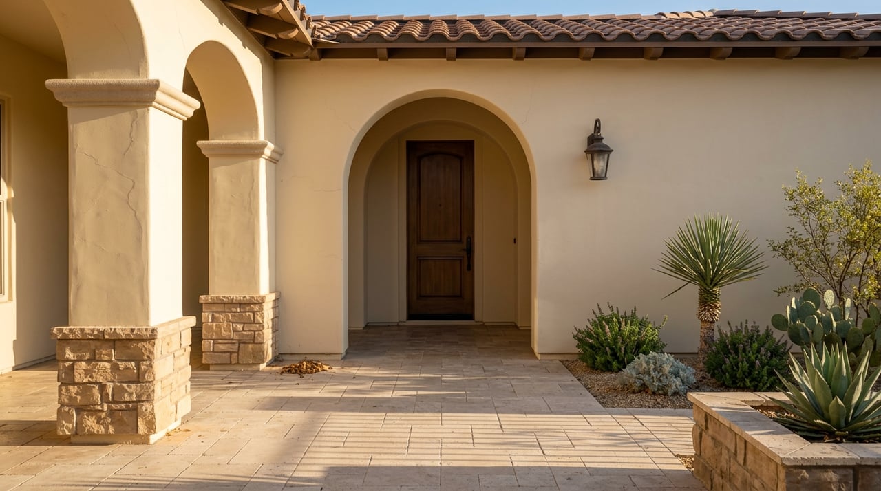
Most homes are single-family, with manufactured homes and acreage parcels also available. Because the city was conceived as a large planned community, you’ll see a mix of built neighborhoods and undeveloped lots. That patchwork feel is part of the area’s character and helps preserve the sense of space. For general background, review the city overview on Wikipedia.
Affordability and market pace
Compared with coastal metros, buyers often find more home for the money here. Inventory can be higher than in denser valley communities, and days on market tend to be longer than big-city norms. That slower cadence supports thoughtful decision-making, but you should still get pre-approved and be ready to act when the right property appears. Always verify current pricing and availability with a local MLS snapshot.
Who tends to thrive here
- Remote workers who value quiet, space, and a lower monthly payment.
- Retirees who want calmer streets and clear desert light.
- Families who prioritize affordability and can plan for some longer drives to large-city amenities.
A smart move checklist
Before you decide, use this quick list to ground your choice:
- Visit in two seasons to feel summer heat and cooler evenings.
- Map your weekly errands and test the drive to work, school, and your preferred hospital.
- Confirm broadband options at the exact address and speed tier you need.
- Verify school attendance boundaries and program offerings with the district.
- Ask about utility details, irrigation needs, and any local guidelines for water use.
- Review a recent MLS report to understand active inventory and pricing trends.
Ready to explore California City?
If quiet desert living sounds like a fit, partner with a local team that knows the Antelope Valley block by block. We help you compare neighborhoods, line up financing, and move from search to close with confidence. Reach out to Maritza Arellano for local guidance and a fast, streamlined plan for your next step.
FAQs
Is California City right for someone seeking a slower pace?
- Yes. With low density, quiet neighborhoods, and wide-open views, many people enjoy the calmer day-to-day. Just be ready for longer drives to big-box stores and some services.
What is the climate like in California City?
- It is high desert with hot, dry summers, cooler evenings, and low precipitation. Expect big temperature swings from day to night.
How do commutes work from California City to larger hubs?
- Most residents drive using Highways 14 and 58. Bakersfield is roughly 68 miles and about 1 hour 10 to 15 minutes. Kern Transit Route 250 links to Lancaster and Metrolink for occasional trips.
Are hospitals nearby, and what should I plan for?
- You have clinics and urgent care in town, but full-service hospitals are in Tehachapi and Bakersfield. If specialty care matters, confirm routes and times before you move.
What kinds of homes are common in California City?
- Mostly single-family houses, with some manufactured homes and acreage parcels. The planned-community layout means you will also see undeveloped lots in parts of the city.
What can I do on weekends without a long drive?
- Play a round at Tierra del Sol, hike or photograph Red Rock Canyon, explore OHV areas, and enjoy stargazing from your backyard. These are all close to home.